I use Basecamp From Garmin and the Idaho Topo Map from the GPS Field Depot to open and view these files. They are free programs and files. Download Basecamp. Download Idaho Topo.
Click on the files below to download the gpx file.
2-10-2018 Pickett Creek Ride (Murphy Idaho To Pickett Creek Loop)
10-28-2017 Murphy To Flint Challenging
9-30-2017 Murphy To Flint.gpx
7-9-2017 Mackay Top Of The World.gpx
4-22-2017 Horseshoe Bend to Idaho Cit0424.gpx
5-28-2016 Emmett To Idaho City and Back
06-05-2016-Johnnies Burger Run Near Anderson Dam Idaho
10-29-2016 Murphy to Wagontown Cemetery to Whiskey Mountain
11-12-2016 Owyhee Mountains Idaho Ride Thomas Falls/Lake
11-19-2016 Owyhee Mountains
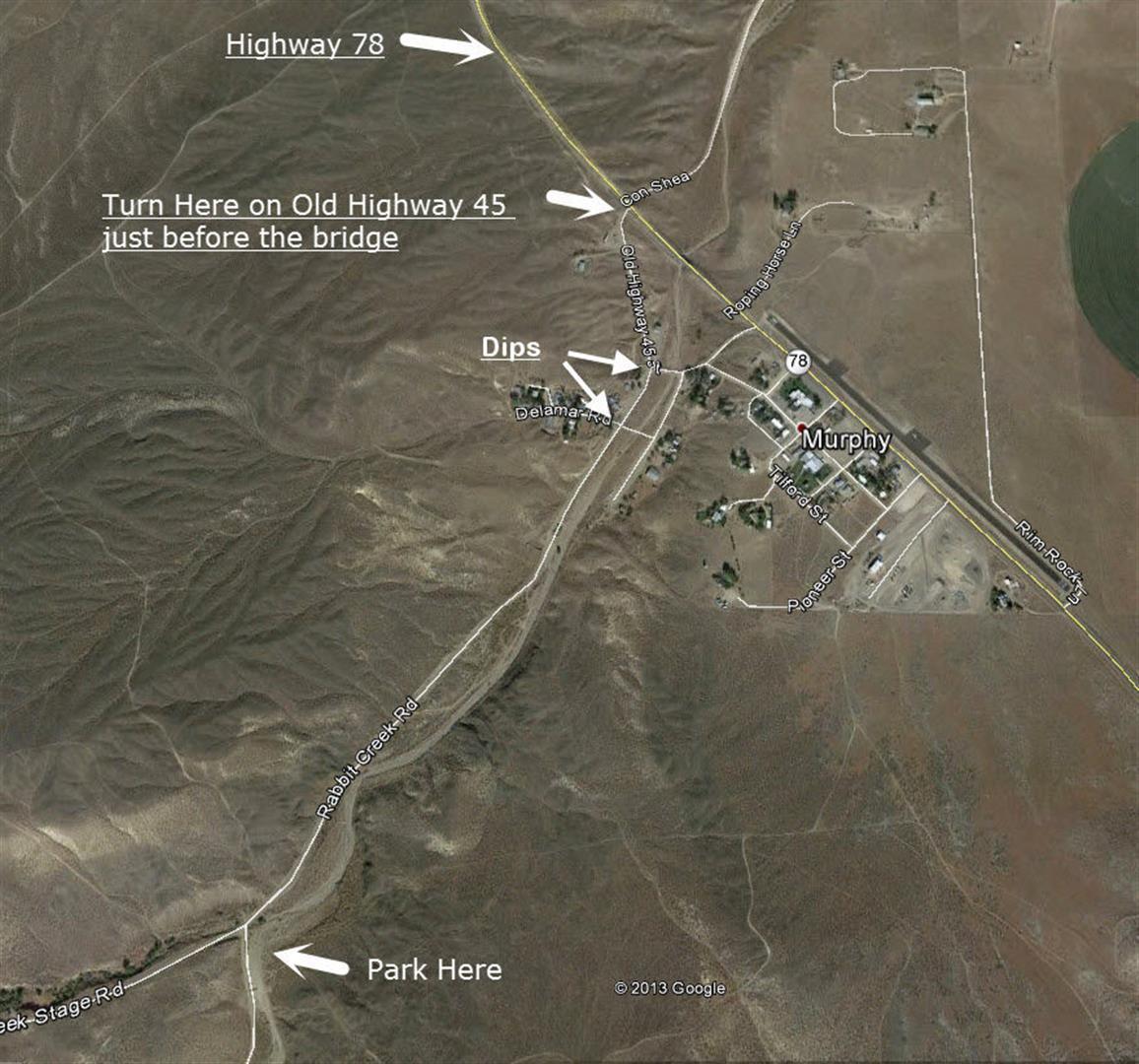
Directions to the Sand Wash in Murphy Idaho:
Directions: 12th Avenue/ Highway 45 South out of Nampa past Dan’s Ferry Service, East on Highway 78 to Murphy. Turn Right, South, on Old Highway 45 just past the 45 MPH speed limit sign. Follow Old Highway 45 to the parking on your left. Watch out for the 2 dips in Old Highway 45!
GPS Unload Location: 43.207710, -116.562645
Map to the Sand Wash in Murphy Idaho: